Practical Cases
Mobile Environmental Risk Prediction
Mobile Environmental Risk Prediction
Aiming to realize Smart Sustainable Mobility services
through AI-based data linkage
Keywords: AI, Mobile environment risk prediction, Cross-data analysis
Overview
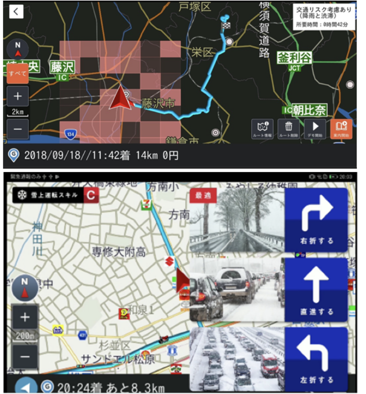
We are conducting research and development of technology for real-time prediction of mobility risks that affect the movement of vehicles and people by utilizing the xData platform, which enables collection, integration, and analysis of transportation and environmental data from various information sources, and distribution and utilization of the results. In addition, NICT is working to realize smart and sustainable transportation services, or Smart Sustainable Mobility services, that contribute to solving mobility issues in each region by utilizing the results of mobility risk prediction.
Possibility of utilizing results
(Social
demonstration)
This technology is implemented on the xData platform on NICT's integrated testbed, which provides APIs and other resources necessary for developing smart services such as action support map applications using mobility risk information. Hackathons are being held to collect and analyze regional traffic and environmental data to optimize mobility risk forecasts for each region, and to develop region-specific mobility services by linking them with existing services.
Application examples
-

Risk-adaptive Navigation
Information Assets
References
- Ito, S., Zettsu, K.: Report on a Hackathon for Car Navigation Using Traffic Risk Data, 3rd International Conference on Intelligent Traffic and Transportation (ICITT 2019), Amsterdam, The Netherlands (September, 2019).